Portal:New Guinea

The New Guinea Portal
Introduction
Native name: Papua, Niugini, Niu Gini | |
|---|---|
 | |
| Geography | |
| Location | Oceania (Melanesia) |
| Archipelago | Melanesia and Malay Archipelago |
| Area | 785,753 km2 (303,381 sq mi) |
| Area rank | 2nd |

New Guinea (Tok Pisin: Niugini; Hiri Motu: Niu Gini; Indonesian: Papua, fossilized Nugini, also known as Papua or historically Irian) is the world's second-largest island, with an area of 785,753 km2 (303,381 sq mi). Located in Melanesia in the southwestern Pacific Ocean, the island is separated from Australia by the 150-kilometre (81-nautical-mile; 93-mile) wide Torres Strait, though both landmasses lie on the same continental shelf, and were united during episodes of low sea level in the Pleistocene glaciations as the combined landmass of Sahul. Numerous smaller islands are located to the west and east. The island's name was given by Spanish explorer Yñigo Ortiz de Retez during his maritime expedition of 1545 due to the perceived resemblance of the indigenous peoples of the island to those in the African region of Guinea. (Full article...)
Papua New Guinea, officially the Independent State of Papua New Guinea, is an island country in Oceania that comprises the eastern half of the island of New Guinea and offshore islands in Melanesia, a region of the southwestern Pacific Ocean north of Australia. It has a land border with Indonesia to the west and maritime borders with Australia to the south and the Solomon Islands to the east. Its capital, on its southern coast, is Port Moresby. The country's 462,840 km2 (178,700 sq mi) includes a large mainland and hundreds of islands. (Full article...)
Western New Guinea, also known as Papua, Indonesian New Guinea, and Indonesian Papua, is the western half of the island of New Guinea, formerly Dutch and granted to Indonesia in 1962. Given the island is alternatively named Papua, the region is also called West Papua (Indonesian: Papua Barat). It is one of the seven geographical units of Indonesia in ISO 3166-2:ID. (Full article...)
Selected article -
-

The Battle of Rabaul, also known by the Japanese as Operation R, an instigating action of the New Guinea campaign, was fought on the island of New Britain in the Australian Territory of New Guinea, from 23 January into February 1942. It was a strategically significant defeat of Allied forces by Japan in the Pacific campaign of World War II, with the Japanese invasion force quickly overwhelming the small Australian garrison, the majority of which was either killed or captured. Hostilities on the neighbouring island of New Ireland are usually considered to be part of the same battle. Rabaul was significant because of its proximity to the Japanese territory of the Caroline Islands, site of a major Imperial Japanese Navy base on Truk.
Following the capture of the port of Rabaul, Japanese forces turned it into a major base and proceeded to land on mainland New Guinea, advancing toward Port Moresby. Heavy fighting followed along the Kokoda Track, and around Milne Bay, before the Japanese were eventually pushed back towards Buna–Gona by early 1943. As part of Operation Cartwheel, throughout 1943–1945, Allied forces later sought to isolate the Japanese garrison on Rabaul, rather than capturing it, largely using air power to do so, with US and Australian ground forces pursuing a limited campaign in western New Britain during this time.
By the end of the war, there was still a sizeable garrison at Rabaul, with large quantities of equipment that were subsequently abandoned. In the aftermath, it took the Allies over two years to repatriate the captured Japanese soldiers, while clean up efforts continued past the late 1950s. Many relics including ships, aircraft and weapons, as well as abandoned positions and tunnels, remain in the area. (Full article...) -

Highlands Highway in Eastern Highlands Province
The Highlands Highway, sometimes known as the Okuk Highway, is the main land highway in Papua New Guinea. It connects several major cities and is vital for the movement of people and goods between the populous Highlands region and the coast.
For most of its length the Highlands Highway is no more than a single carriageway two-lane road that is often hindered by potholes and land slips. It is also notorious, particularly in the Highlands region, for being the place of numerous armed hold-ups and robberies committed by local bandits called raskols. (Full article...) -

Japanese settlement in the Territory of Papua and German New Guinea (in what now constitutes modern-day Papua New Guinea) dates back to the early 20th century when migrants from Japan established copra plantations and trading businesses in the islands, specifically Rabaul. The Japanese community remained small throughout the first half of the 20th century, although there were Japanese migrating in and out of New Guinea in different years from 1901 to 1945, it generally never exceeded more than 100 as a whole community. Some Japanese stayed for short terms and were replaced by newer emigrants from Japan, others stayed for longer periods depending on their roles. Most Japanese in Papua were businessmen and plantation managers, although a few became fishermen. As almost all the migrants were men, many of them married local Papuan wives and raised mixed-race Japanese-Papuan families while other Japanese men staying only for short periods also had sexual cohabitations with local Papuan women, but in most cases without marrying. Many of them did produce offspring but they were generally abandoned by their Japanese fathers (some of whom were already married with children in Japan) and raised by their single Papuan mothers or sent to the orphanage. These abandoned mixed-race children's were recorded as ethnic Papuans in the census as the ethnicity of their fathers was unknown.
During World War II, the Imperial Japanese Army invaded New Guinea with 350,000 troops and occupied most of its territory from January 1942 to August 1945. Some Papuan women including mixed-race Japanese-Papuan women were forced to become comfort women. Most Japanese in the unoccupied areas of New Guinea were deported to Australia where they were confined. The majority of them were repatriated to Japan after the war, although their mixed-race children were allowed to remain behind and assimilated with the local populace. Official estimates show 207 Japanese-Papuan mixed descendants. (Full article...) -

The New Guinea singing dog or New Guinea Highland dog (Canis lupus hallstromi) is an ancient (basal) lineage of dog found in the New Guinea Highlands, on the island of New Guinea. Once considered to be a separate species in its own right, under the name Canis hallstromi, it is closely related to the Australian dingo. The dog is relatively unusual among canines; it is one of the few to be considered "barkless", and is known for the unusual "yodel"-like style of vocalizing that gives it its name.
In 1989, the Australian mammalogist Tim Flannery took a photo of a black-and-tan dog in Telefomin District. He noted that these dogs lived with local tribal peoples in the mountains, and that feral populations lived in the alpine and sub-alpine grasslands of the Star Mountains and the Wharton Range. The photo was published in his book, Mammals of New Guinea. In 2012, Australian wilderness-adventure guide Tom Hewett took a photo of a tawny, thick-coated dog in the Puncak Mandala region of West Papua, Indonesia. In 2016, a literature review found no definitive evidence that the earliest possible dogs, within captive populations of New Guinea singing dogs, were wild animals; successive generations of puppies were raised as members of village populations, thus being domestic dogs.
In 2020, a genetic study found that the New Guinea Highland wild dogs were genetically basal to the dingo and the New Guinea singing dog, and therefore the potential originator of both. (Full article...) -

East New Britain is a province of Papua New Guinea, consisting of the north-eastern part of the island of New Britain and the Duke of York Islands. The capital of the province is Kokopo, not far from the old capital of Rabaul, which was largely destroyed in a volcanic eruption in 1994. East New Britain covers a total land area of 15,816 square kilometres (6,107 sq mi), and the province's population was reported as 220,133 in the 2000 census, rising to 328,369 in the 2011 count. Provincial coastal waters extend over an area of 104,000 square metres (26 acres). The province's only land border is with West New Britain Province to the west, and it also shares a maritime border with New Ireland Province to the east.
East New Britain has a dual economy: a cash economy operates side by side with the subsistence-farming sector. The main crops produced for export are cocoa and copra. Tourism continues to be an increasingly important sector of the provincial economy. (Full article...) -

The Papuan Peninsula, also known as the Bird's Tail Peninsula, is a large peninsula in Papua New Guinea, southeast of the city of Lae, that makes up the southeastern portion of the island of New Guinea. The peninsula is the easternmost extent of the New Guinea Highlands and consists largely of the Owen Stanley Range, with peaks such as Mount Victoria (4,038 m) and Mount Suckling (3,676 m). On the south coast is Port Moresby, the capital and largest city of Papua New Guinea.
The island of New Guinea is often visualized as being in the shape of a bird, with the Bird's Head Peninsula being at the northwest end of the island, and the Bird's Tail Peninsula at the southeast end. For example, American soldiers in WWII visualized it specifically as a turkey, and referenced the anatomy of the bird as a shorthand for explaining where various actions and deployments occurred on the island.
The island has also been visualised as a lizard. (Full article...) -
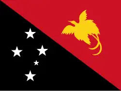
Corruption in Papua New Guinea is rife.
According to The Economist, "PNG's governments are notorious for corruption, and ever run the risk of turning the state into a fully-fledged kleptocracy".
Transparency International's Corruption Perceptions Index scores 180 countries according to the perceived corruption of their public sector on a scale from 0 ("highly corrupt") to 100 ("very clean"). Those countries are then ranked by their score; the country ranked first is perceived to have the most honest public sector. In the 2024 Index, Papua New Guinea scored 31 and ranked 127th. For comparison with regional scores, the highest score among the countries of the Asia Pacific region was 84, the average score was 44 and the lowest score was 16. For comparison with worldwide scores, the best score was 90 (ranked 1), the average score was 43, and the worst score was 8 (ranked 180).
Papua New Guinea is below the satisfactory levels set by the United Nations Convention against Corruption (UNCAC), according to a report submitted by Transparency International Papua New Guinea (TIPNG) in 2011. TIPNG’s report found that in many cases, anti-corruption bodies in PNG were restricted by shortcomings in financial resources. (Full article...) -
Severe Tropical Cyclone Monica was the most intense tropical cyclone, in terms of maximum sustained winds, on record to impact Australia. The 17th and final storm of the 2005–06 Australian region cyclone season, Monica originated from an area of low pressure off the coast of Papua New Guinea on 16 April 2006. The storm quickly developed into a Category 1 cyclone the next day, at which time it was given the name Monica. Travelling towards the west, the storm intensified into a severe tropical cyclone before making landfall in Far North Queensland, near Lockhart River, on 19 April 2006. After moving over land, convection associated with the storm quickly became disorganised.
On 20 April 2006, Monica emerged into the Gulf of Carpentaria and began to re-intensify. Over the following few days, deep convection formed around a 37 km (23 mi) wide eye. Early on 22 April 2006, the Bureau of Meteorology (BoM) assessed Monica to have attained Category 5 status, on the Australian cyclone intensity scale. The Joint Typhoon Warning Center (JTWC) also upgraded Monica to a Category 5-equivalent cyclone, on the Saffir–Simpson Hurricane Scale. The storm attained its peak intensity the following day with winds of 250 km/h (160 mph) 10-minute winds) and a barometric pressure of 916 hPa (mbar; 27.05 inHg). On 24 April 2006, Monica made landfall about 35 km (22 mi) west of Maningrida, at the same intensity. Rapid weakening took place as the storm moved over land. Less than 24 hours after landfall, the storm had weakened to a tropical low. The remnants of the former-Category 5 cyclone persisted until 28 April 2006 over northern Australia.
In contrast to the extreme intensity of the cyclone, relatively little structural damage resulted from it. No injuries were reported to have occurred during the storm's existence and losses were estimated to be A$6.6 million (US$5.1 million). However, severe environmental damage took place. In the Northern Territory, an area about 7,000 km2 (2,700 sq mi) was defoliated by Monica's high wind gusts. In response to the large loss of forested area, it was stated that it would take several hundred years for the area to reflourish because of the large area it devastated. (Full article...) -
The Bird's Head Peninsula (Indonesian: Kepala Burung, Dutch: Vogelkop, meaning Bird's Head in Indonesian and Dutch) or Doberai Peninsula (Semenanjung Doberai) is a large peninsula that makes up the northwest portion of the island of New Guinea, comprising the Indonesian provinces of Southwest Papua and West Papua. It is often referred to as The Vogelkop, and is so named because its shape looks like a bird's head on the island of New Guinea. The peninsula at the opposite end of the island (in Papua New Guinea) is called the Bird's Tail Peninsula. The peninsula just to the south is called the Bomberai Peninsula. (Full article...) -
The Papua New Guinea national soccer team is the men's national soccer team of Papua New Guinea and is controlled by the Papua New Guinea Football Association. Its nickname is the Kapuls, which is Tok Pisin for Cuscus.
Papua New Guinea's highest ever FIFA ranking was 153, in June 2017. As of April 2024, the country was ranked 166 out of 211 countries. This was a drop of 1 place from February 2024. Papua New Guinea had previously left the FIFA rankings, having not competed in a match between July 2007 and August 2011. Their matches at the 2015 Pacific Games saw them return to the rankings, and they competed in the 2016 OFC Nations Cup in June 2016; they reached the final, but lost to New Zealand 4–2 on penalties after the score was tied at 0–0 after extra time. (Full article...) -
The Australian boobook (Ninox boobook), is a species of owl native to mainland Australia, southern New Guinea, the island of Timor, and the Sunda Islands. Described by John Latham in 1801, it was generally considered to be the same species as the morepork of New Zealand until 1999. Its name is derived from its two-tone boo-book call. Eight subspecies of the Australian boobook are recognized, with three further subspecies being reclassified as separate species in 2019 due to their distinctive calls and genetics.
The smallest owl on the Australian mainland, the Australian boobook is 27 to 36 cm (10.5 to 14 in) long, with predominantly dark-brown plumage with prominent pale spots. It has grey-green or yellow-green eyes. It is generally nocturnal, though sometimes it is active at dawn and dusk, retiring to roost in secluded spots in the foliage of trees. The Australian boobook feeds on insects and small vertebrates, hunting by pouncing on them from tree perches. Breeding takes place from late winter to early summer, using tree hollows as nesting sites. The International Union for Conservation of Nature has assessed the Australian boobook as being of least concern on account of its large range and apparently stable population. (Full article...) -
Kiwai Island is the largest island in the Fly River delta, Papua New Guinea. It is 59 km (37 mi) long along the northwest–southeast axis from Wamimuba Point in the northwest to the village of Saguane (Sanguane) in the south, and up to 9 km (5.6 mi) wide, with an average width of 5.6 km (3.5 mi). Its area is 359 km2 (139 sq mi). Neighboring Purutu and Wabuda Islands to the north and northeast are also among the three largest islands in the Fly River delta. A language study mentioned a population of about 4,500, but the census of population of 2000 showed only 2,092 inhabitants. (Full article...) -
The Papua New Guinea Premier Soccer League is the men's top division of professional soccer in Papua New Guinea. It is a nationwide league formed in 2006 by Papua New Guinea Football Association.
It replaced the Papua New Guinea National Club Championship as the country's major soccer competition.
The competition has been won by only two clubs. Hekari United won the first eight editions, while Lae City have won the rest. The two clubs have met in two Grand Finals, in 2015–16 and 2019, with Lae City winning both. (Full article...) -
Lae (/ˈlɑːeɪ, ˈleɪi/, German: Preußen-Reede, later Lehe) is the capital of Morobe Province and is the second-largest city in Papua New Guinea. It is located near the delta of the Markham River on the northern coast of Huon Gulf. It is at the start of the Highlands Highway, which is the main land transport corridor between the Highlands Region and the coast. Lae is the largest cargo port of the country and is the industrial hub of Papua New Guinea. The city is known as the Garden City and home of the Papua New Guinea University of Technology. (Full article...) -
Sir Julius Chan (29 August 1939 – 30 January 2025) was a Papua New Guinean politician who served as Prime Minister of Papua New Guinea from 1980 to 1982 and from 1994 to 1997. He was Member of Parliament for New Ireland Province, having won the seat in the 2007 national election. He was also the Governor of New Ireland Province from 2007 until his death in 2025. On 26 May 2019, Prime Minister Peter O'Neill announced he would soon resign and that he wished for Sir Julius to succeed him. An outgoing Prime Minister does not, however, have the power to appoint his successor, and the following day O'Neill delayed his own formal resignation. He was also a leading figure in his country during the years-long Bougainville conflict. (Full article...)
.jpg)


.jpeg)
Did you know (auto-generated)

- ... that Australian official Jack Emanuel was awarded the George Cross in 1971 after being stabbed to death whilst trying to resolve a land dispute with the Tolai people of New Guinea?
- ... that in 1984, more than 10,000 Papuans from West Papua crossed into Papua New Guinea as refugees due to a government crackdown?
- ... that Dorkas Tokoro-Hanasbey, the only female member of the New Guinea Council, arrived thirty minutes late to her inauguration ceremony?
- ... that artifacts of Papua New Guinean art were called "living spirits with fixed abodes"?
- ... that Australiformis semoni is a parasite that infests marsupials in Australia and New Guinea and whose infestation could cause debilitating ulcerative granulomatous gastritis?
- ... that until Rufina Peter and Kessy Sawang's election in August 2022, Papua New Guinea was one of only three countries without a woman in parliament?
General images -
-
.svg.png)
-
 The floristic region of Malesia (from New Guinea)
 -
![Image 3M.S. Rumagesan, Silas Papare, N.L.Suwages, Soegoro Atmoprasodjo [id], and A.H. Nasution in Putra-putra Irian Barat ('Sons of Irian Barat') Conference in Cibogo Bogor, 14–15 April 1961 (from Western New Guinea)](./_assets_/MS_Rumagesan%252C_Silas_Papare%252C_NL_Suwages%252C_Sugoro%252C_dan_AH_Nasution_berbincang-bincang%252C_Konferensi_Cibogo.jpg) M.S. Rumagesan, Silas Papare, N.L.Suwages, Soegoro Atmoprasodjo, and A.H. Nasution in Putra-putra Irian Barat ('Sons of Irian Barat') Conference in Cibogo Bogor, 14–15 April 1961 (from Western New Guinea)
M.S. Rumagesan, Silas Papare, N.L.Suwages, Soegoro Atmoprasodjo, and A.H. Nasution in Putra-putra Irian Barat ('Sons of Irian Barat') Conference in Cibogo Bogor, 14–15 April 1961 (from Western New Guinea) -

-
 Papua New Guinea map of Köppen climate classification (from New Guinea)
 -
 Trans-New Guinea languages (multi-coloured), Austronesian languages (gold), and other languages (grey) (from Western New Guinea)
 -

-
Korowai tribesman (from New Guinea)
-
 Fishing boats in Biak (from Western New Guinea)
 -

-
.png) New Guinea from 1884 to 1919. The Netherlands controlled the western half of New Guinea, Germany the north-eastern part, and Britain the south-eastern part. (from New Guinea)
New Guinea from 1884 to 1919. The Netherlands controlled the western half of New Guinea, Germany the north-eastern part, and Britain the south-eastern part. (from New Guinea) -
New Guinea from 1884 to 1919. Germany and Britain controlled the eastern half of New Guinea. (from History of Papua New Guinea)
-
 Jayapura, the most populous and largest city on the island of New Guinea (Papua) (from New Guinea)
 -
 Regions of Oceania: Australasia, Polynesia, Micronesia, and Melanesia. Australasia includes the Australian landmass (including Tasmania), New Zealand, and New Guinea. (from History of Papua New Guinea)
 -
 Sentani International Airport in Jayapura is the principal point of entry to Papua (from Western New Guinea)
 -
 West Papuan separatists raising the Morning-Star flag in the jungles of Papua, 1971 (from Western New Guinea)
 -
 Koiari village near Bootless Inlet, British New Guinea (from History of Papua New Guinea)
 -
 Political divisions of New Guinea (2006) (from New Guinea)
 -
 A 1644 map of New Guinea and the surrounding area (from New Guinea)
 -
-
 Dutch colonial civil servant in the Baliem Valley, 1958 (from Western New Guinea)
 -
 Free West Papua protest in Melbourne, Australia, August 2012. (from Western New Guinea)
 -
%252C_Pairi_daiza_2.jpg) Dorcopsis hageni, native to northern region of New Guinea. (from Western New Guinea)
Dorcopsis hageni, native to northern region of New Guinea. (from Western New Guinea) -
 Flag under German control of New Guinea. (from History of Papua New Guinea)
 -
 Topographical map of New Guinea (from New Guinea)
 -
 Grasberg Mine in Mimika Regency. Mining is the most important sector in the province (from Western New Guinea)
 -
 The lowland rainforest of the Western New Guinea (from Western New Guinea)
 -
 Youtefa Bridge, currently the longest bridge in Papua (from Western New Guinea)
 -

-
 Map of New Guinea, with place names as used in English in the 1940s (from New Guinea)
 -

-
Regions of Oceania: Australasia, Polynesia, Micronesia, and Melanesia. Physiographically, Australasia includes the Australian landmass (including Tasmania), New Zealand, and New Guinea (from New Guinea)
-
.jpg) Highlands of Papua New Guinea (from New Guinea)
Highlands of Papua New Guinea (from New Guinea) -
 New Guinea crocodile (from New Guinea)
 -
.jpg) Australian forces attack Japanese positions during the Battle of Buna–Gona, 7 January 1943. (from History of Papua New Guinea)
Australian forces attack Japanese positions during the Battle of Buna–Gona, 7 January 1943. (from History of Papua New Guinea) -
 Hoisting the German flag at Mioko in 1884 (from History of Papua New Guinea)
 -
 Since 2002, display of the flag of West Papua is allowed in West Papua only if accompanied by, and not raised higher than, the flag of Indonesia. (from Western New Guinea)
 -
 Papuans on the Lorentz River, photographed during the third South New Guinea expedition in 1912–13 (from New Guinea)
 -
 Dutch expeditions in Netherlands New Guinea 1907–1915. (from Western New Guinea)
 -
 Mount Bosavi (from New Guinea)
 -
 The raggiana bird-of-paradise is native to New Guinea. (from New Guinea)
 -
 A Japanese military map of New Guinea from 1943 (from New Guinea)
 -
 Papeda, a notable dish originating from Eastern Indonesia (from Western New Guinea)
 -
 Yali Mabel, Kurulu Village War Chief at Baliem Valley (from New Guinea)
 -
 New Guinea located in relation to Melanesia (from New Guinea)
 -
 Rp 0.12 Indonesian stamp of 1963. (from Western New Guinea)
 -
 Dutch and Papuan officials during the opening of the Central Hospital in Hollandia, 1959 (from Western New Guinea)
 -
 British flag raised in Queensland 1883 (from History of Papua New Guinea)
 -
 Culture parade in Biak (from Western New Guinea)
 -
 The continent of Sahul before the rising ocean sundered Australia and New Guinea after the last ice age (from New Guinea)
 -
 An Australian soldier, Private George "Dick" Whittington, is aided by Papuan orderly Raphael Oimbari, near Buna on 25 December 1942. (from History of Papua New Guinea)
 -
 Group of natives at Mairy Pass. Mainland of British New Guinea in 1885. (from New Guinea)
 -
 Handover ceremony of West Irian Governorship from Jan Bonay to Frans Kaisiepo, 1965 (from Western New Guinea)
 -
Map showing the combined landmass of Sahul formed during Pleistocene glacations (from New Guinea)
-
 Australian troops at Milne Bay, Papua.The Australian garrison was the first to inflict defeat on the Imperial Japanese Army during World War II at the Battle of Milne Bay of Aug–Sep 1942. (from History of Papua New Guinea)
 -
 Australian patrol officer in 1964 (from History of Papua New Guinea)
 -
 Skouw border checkpoint, on the Indonesia-Papua New Guinea border (from Western New Guinea)
 -
 The king bird-of-paradise is one of over 300 bird species on the peninsula. (from Western New Guinea)
 -
 Fort Du Bus in 1828 (from Western New Guinea)
 -
 The Sukarno-era West Irian Liberation Monument in Lapangan Banteng, Jakarta. (from Western New Guinea)
 -
 Kerepunu women at the marketplace of Kalo, British New Guinea, 1885 (from History of Papua New Guinea)
 -
 Australian soldiers resting in the Finisterre Ranges of New Guinea while en route to the front line (from New Guinea)
 -
 Western New Guinea was formally annexed by Indonesia in 1969. (from New Guinea)
 -
 Paradisaea apoda, native to Papua, displaying its feathers (from Western New Guinea)
 -
 Coral reefs in Papua New Guinea (from New Guinea)
 -
A typical map from the Golden Age of Netherlandish cartography. Australasia during the Golden Age of Dutch exploration and discovery (ca. 1590s–1720s): including Nova Guinea (New Guinea), Nova Hollandia (mainland Australia), Van Diemen's Land (Tasmania), and Nova Zeelandia (New Zealand). (from History of Papua New Guinea)
-
 A section of Trans-Papua Highway connecting Deiyai and Mimika in Central Papua (from Western New Guinea)
 -
 The Nagarakertagama mentioned a region in the east called Wanin, present-day Onin Peninsula in the Fakfak Regency, West Papua (from Western New Guinea)
 -
.jpg) New Guinea Volunteer Rifles with captured Japanese flag, 1942 (from History of Papua New Guinea)
New Guinea Volunteer Rifles with captured Japanese flag, 1942 (from History of Papua New Guinea) -
 Yali in the Yahukimo Regency (from Western New Guinea)
 -
 Sago is a typical Papuan food, which is usually made into papeda. (from Western New Guinea)
 -
Dutch expeditions in Netherlands New Guinea 1907–1915. (from Western New Guinea)
-
 The rugged and mountainous topography of Western New Guinea. (from Western New Guinea)
 -
 Female gable image, Sawos people, Oceanic art in the Bishop Museum (from History of Papua New Guinea)
 -
.jpg)
Related portals








WikiProjects

- WikiProject Papua New Guinea
- WikiProject Indonesia
- WikiProject Melanesia
General topics
Categories

Associated Wikimedia
The following Wikimedia Foundation sister projects provide more on this subject:
-
 Commons
Free media repository -
 Wikibooks
Free textbooks and manuals -
 Wikidata
Free knowledge base -
 Wikinews
Free-content news -
 Wikiquote
Collection of quotations -
 Wikisource
Free-content library -
 Wikiversity
Free learning tools -
 Wiktionary
Dictionary and thesaurus
External media

More portals
-
 List of all portals
 -

-

-

-

-

-

-

-

-

-
 Random portal
 -
 WikiProject Portals